Wednesday, May 4, 2011

Around and About


On our first full day at Fundy, we actually drove north all the way to Moncton. We needed to get a Canadian equivalent (prepay with a "rocket stick") to our Verizon aircard for internet, and Bill really needed it right away for work. Unfortunately, we had some very frustrating, bad experiences (with Rogers - short story? Avoid this company if you can!! We only went with them first because Virgin was out of what we wanted at the time) before finally getting Virgin Mobile (go with this one! MUCH better service, help, and cheaper too!). So this day felt like a wasted day - spent driving in the city and walking in malls! Yucky! Definitely not what I'd expected when staying in a national park!!! But, we did at leastget to see some scenic stuff on the way back.


We stopped at Hopewell Rocks. They were kind of cool, and it was a pretty day to see them - partly cloudy. But I'm not sure it was any more special than much of the Oregon coastline. Now, I realize that doesn't help the Canadians much, and that's why this place ranked so high on the NB tourism scale, I guess. But we were a bit disappointed, esp. with the relatively high fee charged to access the area! And the place was so crowded, I couldn't get to a vantage point at all in this one viewing area. It wasn't till I got onto the stairs going down to the beach that I could see at all what the fuss was all about! So here you can see that again, the tide is out.


Nicer lighting from a different spot (and no crowding - hurrah!).

The Sawmill Creek Bridge, built in 1905.

We saw this in several front yards. Apparently this is what you need to be doing all summer - collecting/stacking firewood - to survive one of their winters!


On another day, I went for a drive on my own (so I could stop for photos!!). Here is an example of some of the cute homes scattered about.


A neato church and cemetary. And yes, I could've removed those wires, but it would've taken me forever with my old, retarded version of Photoshop. And you wouldn't have had the true, authentic feel/experience of the NB countryside that way, would you?!


It was sort of a cloudy, flat, blah lighting afternoon, but I thought this was a pretty scene anyways.


How's that for some cloud cover?


A field of flowers.


Hazy light as the tide rises and fills in the back bay of Alma.

So see all those boats, sitting high on the water? Remember this...you'll need this image to compare a little!


Fun in Fundy


The Bay of Fundy, I guess, technically stretches from Maine up to southern New Brunswick and western Nova Scotia. But Fundy National Park is on the southern shore of NB, and that's where we chose to stay and experience one of the world's highest tidal fluctuations (about 56 feet). Here, you can see Bill perched on his rock, looking down at the Bay, which at this spot is next to the teeny town of Alma.


Cool cloud patterns above the bay. You can see the tide is out here!


The central part of the National Park was covered with beautiful green lawns and neat, colorful rows of flowers (more on this later).


And we experienced all kinds of weather during the four days we were here! Sunny, as in the first photos, but also cloudy and drizzly like in this photo. Fundy was gorgeous in both!


Here we are, nestled in the trees. This was a super park, not only because of the beautiful surroundings, but also because they had full hook-ups, including 50amps!!!! Very rare for any national park I think - Canada or US! Hurrah!!!


Here's Tractor, holding down the driver's seat and enjoying a sunny siesta!

It was interesting - their trash/recycling bins had you separating out between dry and wet materials.


An Out of Country Experience


CANADA!


Finally!


So, on Monday, August 16th we entered New Brunswick, heading for the famous Bay of Fundy. We weren't sure what to expect at the border crossing. Would they search us for too much booze and for guns? Would they require that recent health certificate for each pet that their website said was needed (and that we didn't have! Would've been very expensive to get all that done, so we decided to try without - most people said they didn't ask for that, just about the rabies vax being current)? Would we be turned away and have to try again another day? This was it - we were about to find out!


We lucked out! After just a few questions, the guy let us through no problem. He did ask about all of it, but he didn't ask to come aboard, and I think it's because he could tell Bill was giving him honest answers, not just easy lies. And fortunately, he didn't ask to see any health certificates for the kids! Phew! Probably saved us $300 or more right there!!! So...welcome to NB, Canada, and welcome to both English and French signage.

And some other signs...! This one in particular cracked me up! Bill explained to his goofy wife that it was most likely a truck crossing warning, but it sure looked like a "hey, watch out! you're about to hit the wall!" sign to me!! :)


Friday, April 1, 2011

Quaggy Jo


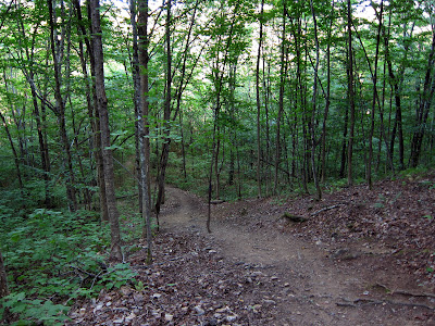
I found another trail on-line in an area I wanted to see. So up I drove, on Route 1, to the Aroostook State Park in Presque Isle. This was Maine's very first state park! And maybe that explains why they hadn't figured out about doing switchbacks on trails yet...(actually, it's probably because it's really primarily a snowmobile trail). This trail (the Quaggy Jo, or QuaQuaJo (Indian name), went straight up! I was looking for tree roots for foot holds!

Dang steep trail. And I went up (and down) the "easy way!"


A good view at the top, although there were so many trees up there it was hard to find much of an opening to peep out of! You can see how agricultural this part of Maine is (mostly potatoes). Kind of surprised me - I thought it'd be much more heavily forested. But you can also see how it must've been so at some point, but centuries of worker bee humans have been making a living there!


Baxter State Park

I had been hoping to explore Baxter State Park for a long time. We had missed it on our last trip because it was so out of the way, and it sounded like a rather difficult, unwelcoming place (slow, dirt, one-way road,...). But the lure of "pure" wilderness and moose and bears - oh my! So I decided to make the trek. First, I researched hiking trails. Would've loved to do Mt. Katahdin, but after really looking at what it entailed, I realized there was no way! It's pretty killer, and I was totally out of shape! I think this is one that you'd better be in top form for! There are different routes up, of varying difficulty, but generally this is a climb, not a hike, with about 4000 feet of gain in ONLY 5 miles!!!! That is steep! That's a climb! And the trail? Mostly huge boulders by the sound of it! And the logistics - getting to the trailhead, getting there early enough, getting a parking spot (they limit the number of park visitors and hikers - and one of these methods is first come, first serve - if there's no parking by the time you get there, you're SOL!), getting a good enough weather day - all made it a no-go for me for this trip. It remains on my life list of to-dos and hopefully the stars will align better on another outing. But I found a hike that sounded do-able and so set off...
stopping along the way for pretty scenes, of course!


Ah, finally. I got very lost on my way to Baxter. First, I got turned around at a town that was totally stopped up because of some parade or event getting started. I outsmarted myself by trying to go around on little side streets and apparently missed my turn-off! I also lost about 1/2 hour in that mess. By the time I realized I must've missed, I was way north of where I wanted to be! After another wrong turn or two, and miles and hours, later, I finally did get on the right road. I had to ask someone going by if I was on the right road though - there really wasn't any indication! I had decided to go up to the northern entrance (Matagamon Gate), thinking I would go again on another day and do the southern entrance (Togue Pond Gate). The park's main through road is something like 50 miles end-to end, and about 20 mph the whole way on a very dirty dirt road. In the above photo, you can see a pretty version of the dust in the air left by my truck!


Baxter State Park is an interesting entity. It was set up by huge land and money donations from the apparently super wealthy 1921-24 governor of Maine, Percival Baxter. It's operated by certain designated ME government officials but not by the normal state park folks. Most of it (75%) is strictly controlled as a wildlife preserve, but 14% of it is "Scientific Forest Management Area" where they harvest timber, and 25% of it allows hunting and trapping (sans moose hunting). They try to keep it wild, uncivilized - there are no facilities in the park - no water, no electricity, no trash containers or pick-up, etc. They want the visitors to have a very peaceful, pristine, pure nature experience. So it was a real irony when I got out of my truck, at the trailhead, to the sound of a female ranger-type loudly ranting on and on to her cohort about some unpleasant work experience or project management dispute! Kind of screwed up my personal peaceful experience!
I made it to the top, the end of my little Trout Brook Farm hike - despite the heat, the delays due to getting lost, the noisy ranger,... It was an OK hike - not one of my favorites. And that, I'd have to say, was true for my whole Baxter experience - not one of my favorites. I still want to do Katahdin, and it'd be good to look for moose around some of the more notoriously moose-ridden ponds in the southern part of the park, but other than that, I wasn't hugely impressed. Maybe I will be more impressed next time. Or maybe next time will be the last time!


This might've been the South Branch Pond - I can't remember and almost don't care - is that bad? My Baxter day almost felt like a wasted day at the end of it, it was so frustrating to have wasted so much time getting lost and having no help in the way of signage or anything, to have been on such a narrow dirty road for so long and not really getting to see much of anything. I'm still undecided as to whether this park is really for visitors to have that "pure nature experience" or just to try and persuade people that they really don't want to come here...! Guess I'm just not hard core enough for this place.


At this South Branch Pond or whatever it is, they did have little huts where people could camp and get out of the weather (other than with their tent).


I was surprised to see an Amish gal, leading her mama and baby horses, down the road! Wow, these folks are everywhere in the eastern half of the country! And even in the harshest weather spots!


I was so pooped out and sort of disenchanted with my Baxter run that I decided against a return trip, so the south section will have to wait for another day...or another life!


Houlton

On Aug. 13th, we moved again - up to Houlton, which is not too far from the most northern reaches of eastern Maine and a good entry point into New Brunswick, Canada. On the way there, we pulled out at a scenic look-out. Boy, am I glad they could accommodate our big rig! What a view!! In the distance - THE Mt. Katahdin. At 5268 ft, it is the highest point in ME. It's also the northern finish line for the Appalachian Trail, as well as the southern start of the International AT (which I guess currently goes all the way through the Gros Morne National Park in Newfoundland, with plans for it to extend into several more countries! I got to hike on some of the IAT while in Quebec). "My Brother's Place" had a weird name (who knows, maybe it was her brother's place though?!) but was a nice campground. Very pretty. The lady running the place was kind of strange, but I guess that keeps things interesting, right? At one point, she was walking by with her little dog. We said Hi and she came over with her dog. Our kitties were out on their leashes. The little dog was obviously intrigued with the kitties but didn't know how to interact and was resorting to violence. And Ms. Oblivious wasn't doing anything about it!!! She was letting her dog up the ante and become more and more aggressive and not stopping it or moving the dog out of range - and she was in our space! I finally had to loudly and assertively tell her to go away!!!!!!!!! I believe that was the one and only time that happened on our whole trip. Strange, eh? But I'm happy to report that our kitties are not generalizing and holding it against all dogs. Maybe they realized that it was a case of "like mother, like son" or something - they were BOTH strange! But while you sometimes run into weirdos, you also run into genuinely good, aware, smart, well-rounded, and nice people too. Bill really enjoyed talking it up with this new neighbor, who was definitely one of the latter types. Meanwhile, the critters helped hold down the picnic tables and grass (we just hate it when those things get away from us!).
Tractor shadow boxes, while...in the box.

(yes, he IS that much of a character!)


More on The Pumpkins...


The Pumpkin Patch was a nice place to stay. It was also where we met some nice folks, including one couple who had just been on a caravan tour of the Canadian Atlantic Maritimes - right where we were heading! Jim was a good source of info., and he also very generously gave us their Canadian park passes, saving us a boatload of $!!!!! Thank you Jim!!!!!!!!!!!! I'm not sure we would've stayed at any/many Canadian parks otherwise, because the total costs would've been about $60-70/nt instead of our usual $20-40 (and some places - like AL's Corp. of Engineer parks were only $9/nt for seniors!!!)!!!!! We still paid the campground fees (usually $35-40/nt or so) but didn't have to pay the extra daily permit fees to be in the park. Phew! And they have some wonderful parks, so it would've been a shame to miss them.


The kids liked it there too. Lots of good spots to explore.


Everyone loved their walks on the mown paths in the back, esp. the kitties.


Visiting with one of our nice neighbors - and her kitty and doggy.


Downtown Bangor.


Another nice neighbor!


Bye-bye Pumpkin Patch!